
The Geography of West Virginia
Click here for a few definitions.
| Longitude / Latitude |
Longitude: 77° 40'W to 82° 40'W
Latitude: 37° 10'N to 40° 40'N |
|
| Length x Width |
West Virginia is about 240 miles long and 130 miles wide. |
|
Geographic Center
Explanation |
The
geographic center
of West Virginia is located in Braxton County, 4 miles east of Sutton.
Longitude: 80° 42.2'W
Latitude: 38° 35.9'N |
|
| Borders |
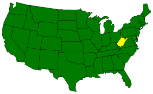
West Virginia is bordered by Ohio,
Pennsylvania, and Maryland on the north and
by Virginia on the south. On the east, West Virginia is bordered by
Pennsylvania, Maryland, and
Virginia. On the west, West Virginia is bordered by
Ohio and Kentucky. This
map of West Virginia
will show you all of its neighbors. |
| Total Area |
West Virginia covers 24,231 square miles, making it the 41st largest of the
50 states. |
| Land Area |
24,087 square miles of West Virginia are land areas. |
| Water Area |
145 square miles of West Virginia are covered by water. |
| Highest Point |
The highest point in West Virginia is
Spruce Knob
at 4,863 feet above sea level.
Click here
for more about Spruce Knob. |
| Lowest Point |
The lowest point in West Virginia is the Potomac River at 240 feet above sea level. |
| Mean Elevation |
The Mean Elevation of the state of West Virginia is 1,500 feet above sea level. |
| Major Rivers |
Ohio River, Guyandotte River, Greenbrier River |
| Major Lakes |
Tygart Lake, Bluestone Lake |
The Land |
|
West Virginia's nickname, the Mountain State, is well deserved. Some of the most rugged land in the
country can be found in this, one of the smaller states; only nine states are smaller in total area. Most
of the level land areas found in West Virginia are flat strips that lie along the major rivers. If you're
traveling in this state and you're not traveling along a river, chances are you'll either be going uphill
or you'll be going downhill.
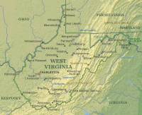
West Virginia's state boundaries tend to follow the lay of the land, winding between mountains along
riverbeds or along mountain ridges. These wandering boundaries give West Virginia a unique outline. In
northern West Virginia, there are two interesting land extensions that seem to intrude upon neighboring
states. The land that extends eastward between Maryland and Virginia is referred to as the
Eastern Panhandle.
The strip of land that extends north between Ohio and Pennsylvania is referred to as the
Northern Panhandle.
The land areas of this state are characterized by the Appalachian Ridge and Valley Region and the
Appalachian Plateau.
Appalachian Ridge and Valley Region: Part of the Appalachian Mountain system, the Allegheny and
Blue Ridge Mountain Ranges run in a broad strip from northeast West Virginia southwest across the eastern
1/6 of the state. These mountains are characterized by long parallel ridges. Streams run through the
valleys that separate these ridges.
The forested mountains of the Appalachian Ridge and Valley Region hide many caves and underground streams.
Along the western edge of the mountains is the Allegheny Front, the place where the more sharp, rugged
mountains of the east meet the more rolling terrain of the Appalachian Plateau. Many of the peaks in
this area of West Virginia rise to over 4,000 feet above sea level.
Spruce Knob,
the highest point in West Virginia, rises 4,863 feet above sea level in the Appalachian Ridge and Valley Region.
Appalachian Plateau: West of the Appalachian Ridge and Valley Region, the Appalachian Plateau
covers 5/6 of West Virginia. This land area, also rugged, is marked by flat-topped highlands and
more rounded hills as opposed to the more sharply defined landscape to the east.
( West Virginia Close-up ) |
| Climate (All temperatures Fahrenheit) |
| Highest Temperature |
The highest temperature recorded in West Virginia is 112°, Fahrenheit. This record high
was recorded on July 10, 1935 at Martinsburg. |
| Lowest Temperature |
The lowest temperature in West Virginia, -37°, was recorded on December 30, 1917 at Lewisburg. |
| Average Temperature |
Monthly average temperatures range from a high of 85.6 degrees to a low of 23.9 degrees. |
| Climate |
Average yearly precipitation for West Virginia, from 1971 to 2000, is shown on
this chart from Oregon State University. |
|


;)
;)