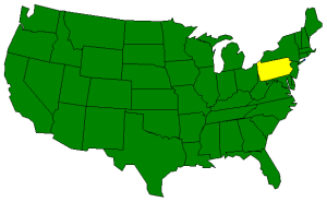

The Geography of Pennsylvania
Click here for a few definitions.
| Longitude / Latitude |
Longitude: 74° 43' W to 80° 31' W
Latitude: 39° 43' N to 42° N |
|
| Length x Width |
Pennsylvania is 283 miles long, from east to west, and 160 miles wide at its most distant points. |
|
Geographic Center
Explanation |
The
geographic center
of Pennsylvania is located in Centre County, 2.5 miles southwest of Bellefonte.
Longitude: 77° 44.8'W
Latitude: 40° 53.8'N |
|
| Borders |
Pennsylvania is bordered by New York and
Lake Erie to the north. In
the south, Pennsylvania shares borders with West Virginia,
Maryland, Delaware, and
New Jersey. To the east, New York and New Jersey line up on the Pennsylvania
border. Pennsylvania meets Ohio and an arm of West Virginia on the West. |
| Total Area |
Pennsylvania covers 46,058 square miles, making it the 33rd largest of the
50 states. |
| Land Area |
44,820 square miles of Pennsylvania are land areas. |
| Water Area |
1,239 square miles of Pennsylvania are covered by water. |
| Highest Point |
The highest point in Pennsylvania is Mt. Davis at 3,213 feet. |
| Lowest Point |
The lowest point in Pennsylvania is in The Delaware River
at sea level. |
| Mean Elevation |
The Mean Elevation of the state of Pennsylvania is 1,100 feet above sea level. |
| Major Rivers |
Allegheny River, Susquehanna River, Delaware River, Ohio River |
| Major Lakes |
Lake Erie |
The Land |
| The Allegheny Mountains run diagonally from the southwest to the northeast with piedmont and coastal plains
in the southeast triangle. The Allegheny Front, as it's called, cuts a diagonal line across the state.
In the northwest, the plateau falls to the Lake Erie lowlands and, finally, Lake Erie.
( Pennsylvania Close-up ) |
| Climate (All temperatures Fahrenheit) |
| Highest Temperature |
The highest temperature recorded in Pennsylvania is 111°, Fahrenheit. This record high
was recorded on July 10, 1936 at Phoenixville. |
| Lowest Temperature |
The lowest temperature recorded in Pennsylvania was 42° below zero. This temperature was
hit on Jan 5, 1904 at Smethport. |
| Average Temperature |
Monthly average temperatures range from a high of 86.2 degrees to a low of 18.0 degrees. |
| Climate |
Average yearly precipitation for Pennsylvania, from 1971 to 2000, is shown on
this chart from Oregon State University. |
|