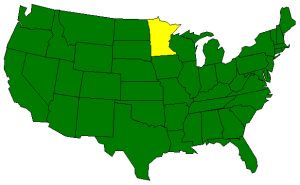
The Geography of Minnesota
Click here for a few definitions.
| Longitude / Latitude |
Longitude: 89° 34'W to 97° 12'W
Latitude: 43° 34'N to 49° 23'N |
|
| Greatest Dimensions |
Minnesota is about 360 miles from east to west and about 407 miles from north to south. |
|
Geographic Center
Explanation |
The
geographic center
of Minnesota is located in Crow Wing County, 10 miles SW of Brainerd.
Longitude: 95° 19.6'W
Latitude: 46° 1.5'N |
|
| Borders |
Minnesota is bordered by Canada on the north and by
Iowa on the south. On the east, Minnesota is
bordered by Lake Superior and by Wisconsin. On the west is
North and South Dakota. |
| Total Area |
Minnesota covers 86,943 square miles, making it the 12th largest of the
50 states. |
| Land Area |
83,574 square miles of Minnesota are land areas. |
| Water Area |
7,326 square miles of Minnesota are covered by water. |
| Highest Point |
The highest point in Minnesota is Eagle Mountain at
2,301 feet above sea level. |
| Lowest Point |
The lowest point in Minnesota is at Lake Superior;
602 feet above sea level. |
| Mean Elevation |
The Mean Elevation of the state of Minnesota is 1,200 feet above sea level. |
| Major Rivers |
Minnesota River, Mississippi River, Rainy River, Red River of the North, St. Croix River |
| Major Lakes |
Upper Red Lake, Lower Red Lake, Mille Lacs Lake, Vermillion Lake,
Rainy Lake, Lake of the Woods, Lake Superior, Leech Lake, Winnibigoshish Lake,
Lake Pepin |
The Land |
| Most of Minnesota is comprised of gently rolling plains formed when glaciers
moved over the area.
The northern part of Minnesota is the most rugged. The northeast section of
the state has many rocky ridges and deep lakes and the area north of Lake Superior
is the roughest and most isolated. Eagle Mountain, the highest point
in Minnesota, is located north of Lake Superior. In the far northeast, the Minnesota
border resembles an arrowhead. This area is called the Arrowhead Country.
About half of Minnesota is covered by the rolling plains left by the ice age.
These areas are covered by fertile topsoil. Though some sections are sandy and
stony, this area has some of the richest farmland in the United States.
Along the Mississippi River, in the southeastern section of the state, the land
is relatively flat, cut by deep valleys created by fast flowing rivers and streams.
In southwestern Minnesota, glaciers left thick deposits of sand, gravel, and clay.
This area is criss-crossed by many streams. The few flat areas make good farmland.
( Minnesota Close-up ) |
| Climate (All temperatures Fahrenheit) |
| Highest Temperature |
The highest temperature recorded in Minnesota is 114°, Fahrenheit. This record high
was recorded on July 6, 1936 at Moorhead. |
| Lowest Temperature |
The lowest temperature in Minnesota, -60°, was recorded on February 2, 1996 at Tower. |
| Average Temperature |
Monthly average temperatures range from a high of 83.4 degrees to a low of -2.9 degrees. |
| Climate |
Average yearly precipitation for Minnesota, from 1971 to 2000, is shown on
this chart from Oregon State University. |
|