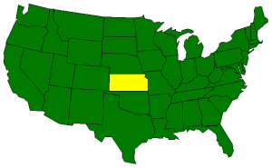
The Geography of Kansas
Click here for a few definitions.
| Longitude / Latitude |
Longitude: 94° 38'W to 102° 1' 34"W
Latitude: 37°N to 40°N |
|
| Length x Width |
Kansas is about 400 miles long and 210 miles wide. |
|
Geographic Center
Explanation |
The
geographic center
of Kansas is located in Barton County, 15 miles NE of Great Bend.
Longitude: 98° 41.9'W
Latitude: 38° 29.9'N |
|
| Borders |
Kansas is bordered by Nebraska on the north and
Oklahoma on the south. To the east is Missouri
and to the west is Colorado. |
| Total Area |
Kansas covers 82,282 square miles, making it the 15th largest of the
50 states. |
| Land Area |
81,823 square miles of Kansas are land areas. |
| Water Area |
459 square miles of Kansas are covered by water. |
| Highest Point |
The highest point in Kansas is
Mount Sunflower
at 4,039 feet above sea level. |
| Lowest Point |
The lowest point in Kansas is the Verdigris River at 679 feet
above sea level. |
| Mean Elevation |
The Mean Elevation of the state of Kansas is 2,000 feet above sea level. |
| Major Rivers |
Arkansas River,
Kansas River,
Missouri River,
Republican River,
Smoky Hill River |
| Major Lakes |
Cheney Reservoir, Tuttle Creek Reservoir |
The Land |
| Gazing upon Kansas, you'll see rolling plains rising in elevation from east to west. Mile after mile
of golden waves highlight Kansas in the early summer as a reminder that this state is the leading
producer of wheat in the United States. The Wheat State can be divided into three geographic regions; the
Dissected Till Plains in the northeast, the Southeastern Plains consisting of the Osage Plains and the Flint
Hills to the west, and the Great Plains covering the western half of the state.
Dissected Till Plains: The Dissected Till Plains lie in the northeastern section of Kansas.
This area of rich soil,
left by glaciers
thousands of years ago, can be roughly defined as the area to the north of the
Kansas River
and to the east of the Big Blue River. Rivers and streams have cut through
(dissected) the landscape in this area creating high bluffs.
Southeastern Plains: South of the Dissected Till Plains, the Southeastern Plains cover Kansas to
the Oklahoma border in the south and extend west toward the center of the state. The landscape is gently
rolling, interrupted by a few hills. The Southeastern Plains can be divided into two sections; the
Osage Plains
and the
Flint Hills.
The Osage Plains, in the east, were formed by the erosion of limestone and shale.
In contrast, the Flint Hills, to the west of the Osage Plains, are composed of erosion resistant limestone
and flint ridges.
The Great Plains: The western half of Kansas is covered by the Great Plains. The land slopes
up from east to west from about 1,500 feet above sea level to around 4,000 feet along the Colorado border. The
High Plains
in the west are a gently rolling landscape similar to the Southeastern Plains to the east but at a higher elevation.
Mount Sunflower,
the highest point in Kansas is located in the Great Plains area near the Colorado border.
( Kansas Close-up ) |
| Climate (All temperatures Fahrenheit) |
| Highest Temperature |
The highest temperature recorded in Kansas is 121°, Fahrenheit. This record high
was recorded on July 24, 1936 at
Alton. |
| Lowest Temperature |
The lowest temperature in Kansas, -40°, was recorded on February 3, 1904 at
Lebanon. |
| Average Temperature |
Monthly average temperatures range from a high of 92.9 degrees to a low of 15.7 degrees. |
| Climate |
Average yearly precipitation for Kansas, from 1971 to 2000, is shown on
this chart from Oregon State University. |
|
Sources:
The World Almanac of the U.S.A. by Allan Carpenter and Carl Provorse, Copyright © 1998
James R. Shortridge, Thomas D. Isern, "Kansas," Discovery Channel School, original content provided by World Book Online, http://www.discoveryschool.com/homeworkhelp/ worldbook/atozgeography/k/294860.html, 08/14/01.
The United States Geological Survey Website
Maps.com http://www.maps.com
 |
|