
The Geography of Florida
Click here for a few definitions.
| Longitude / Latitude |
Longitude: 79° 48' W to 87° 38' W
Latitude: 24° 30' N to 31° N |
|
| Length x Width |
Florida is 500 miles long and 160 miles wide at its most distant points. |
Geographic Center
Explanation |
The
geographic center
of Florida is located in Hernando County, 12 miles NNW of Brooksville.
Longitude: 81° 37.9'W
Latitude: 28° 8.0'N |
| Borders |
Florida is bordered by Georgia and
Alabama to the north. On the west Florida is bordered
by Alabama and the Gulf of Mexico. To the south and to the east, Florida
is surrounded by the Atlantic Ocean. |
| Total Area |
Florida covers 65,758 square miles, making it the 22nd largest of the
50 states. |
| Land Area |
53,997 square miles of Florida are land areas. |
| Water Area |
11,761 square miles of Florida are covered by water making Florida the 3rd wettest
state behind Alaska and Michigan. |
| Highest Point |
The highest point in Florida is
Britton Hill, Lakewood
Park in Walton County and is only 345 feet above sea level. Walton County is located in the Florida Panhandle.
|
| Lowest Point |
The lowest point in Florida is sea level where Florida meets the
Atlantic Ocean and the
Gulf of Mexico. |
| Mean Elevation |
The Mean Elevation of the state of Florida is only 100 feet above sea level. |
| Major Rivers |
St. Johns River,
St. Marys River,
Suwannee River |
| Major Lakes |
Lake Okeechobee,
Lake George |
The Land |
|
The land of swaying palm trees and warm ocean breezes is quite flat with a rolling landscape
to its highest point in the Northwest. Part of three geographic land areas make up the Florida landscape;
the Atlantic Coastal Plain, the East Gulf Coastal Plain and the Florida Uplands.
Atlantic Coastal Plain: The
Atlantic Plain
stretches from Cape Cod, Massachusetts south and around the Florida Peninsula
and the Gulf of Mexico. A part of the Atlantic Plain, the Atlantic Coastal Plain completely covers the
entire eastern part of Florida. The landscape is low and level and varies from about 30 to 90 miles wide.
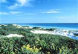
Off the mainland is a narrow strip of sand bars, coral reefs and barrier islands. Most of southern Florida,
2,746 square miles, is covered by the
Big Cypress Swamp and the Florida
Everglades. This area is saturated
with water, especially during the rainy months. To the south of the mainland, lie the Florida Keys curving
out to sea about 150 miles in a southwesterly direction. The largest island of this chain of islands is
Key Largo.
East Gulf Coastal Plain: The East Gulf Coastal Plain, a sub-section of the Atlantic Plain, like the
Atlantic Coastal Plain, presents itself in two sections of Florida. The sections are divided by a portion
of the Florida Uplands. In southwestern Florida, the East Gulf Coastal Plain extends inland to cover
parts of the
Big Cypress Swamp and the
Everglades. The East Gulf Coastal
Plain is similar to the Atlantic Coastal Plain on the other side of the Florida peninsula. Barrier islands
run along the west coast of Florida and coastal swampland extends inland. The northern section of the East
Gulf Coastal Plain curves around the upper edge of the northeastern Gulf of Mexico at Apalachee Bay and extends
west across the Florida panhandle to Florida's western border.
Florida Uplands: From the northwest corner of the state, the Florida Uplands run about 275 miles
west to east, along the northern edge of the Florida Panhandle and then extends south into the central area of
the Florida peninsula. The width of the northern Florida Uplands varies from around 30 to 50
miles and is characterized by low rolling hills of red clay. Hard and softwood forests are plentiful.
The section of the Florida Uplands that extends south into the peninsula, covers an area about 100 miles
wide and 160 miles long. This area extends from the north, south and to the east, to separate the two sections
of the East Gulf Coastal Plain and to separate the East Gulf Coastal Plain from the Atlantic Coastal Plain.
The landscape in the southern Florida Uplands is characterized by low hills and many lakes. Though the
Florida Uplands are only 200-300 feet above sea level, they are still higher than the regions of the Atlantic
Coastal Plain and the East Gulf Coastal Plain. The highest point in Florida is found in the Florida Uplands
that run along the northern edge of the panhandle. Just south of the Alabama
border, west of Paxton,
Britton Hill is 345 feet above sea level
and is the lowest state high point in the nation.
( Florida Close-up ) |
| Climate (All temperatures Fahrenheit) |
| Highest Temperature |
The highest temperature recorded in Florida is 109°, Fahrenheit. This record high
was recorded on June 29, 1931 at Monticello. |
| Lowest Temperature |
The lowest temperature in Florida, -2°, was recorded on February 13, 1899 at Tallahassee, the state capital. |
| Average Temperature |
Monthly average temperatures range from a high of 91.7 degrees to a low of 39.9 degrees. |
| Climate |
Average yearly precipitation for Florida is shown on
CurrentResults weather and science facts. |
|