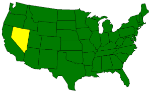
The Geography of Nevada
Click here for a few definitions.
| Longitude / Latitude |
Longitude: 114°W to 120°W
Latitude: 35°N to 42°N |
|
| Length x Width |
Nevada is about 490 miles long and 320 miles wide. |
|
Geographic Center
Explanation |
The
geographic center
of Nevada is located in Lander County, 26 miles SE of Austin.
Longitude: 116° 55.9'W
Latitude: 39° 30.3'N |
|
| Borders |
Nevada is bordered by Oregon and Idaho
on the north and by California on the south. On the east, Nevada
is bordered by Utah and Arizona. On the west,
Nevada is bordered by California. |
| Total Area |
Nevada covers 110,567 square miles, making it the 7th largest of the
50 states. |
| Land Area |
109,806 square miles of Nevada are land areas. |
| Water Area |
761 square miles of Nevada are covered by water. |
| Highest Point |
The highest point in Nevada is
Boundary Peak at 13,140 feet above
sea level. |
| Lowest Point |
The lowest point in Nevada is 479 feet above sea level at the
Colorado River at the southern end of the state. |
| Mean Elevation |
The Mean Elevation of the state of Nevada is 5,500 feet above sea level. |
| Major Rivers |
Colorado River, Columbia River, Humboldt River, Truckee River |
| Major Lakes |
Pyramid Lake, Lake Mead, Lake Mojave, Lake Tahoe, Walker Lake |
The Land |
| The Nevada landscape is represented by sandy deserts, rugged, snow covered mountains,
forested mountain slopes, and grassy valleys. Located almost entirely within the
Great Basin (desert area the reaches into six states), Nevada can be divided into
three main land regions; the Columbia Plateau, the Sierra Nevada, and the Basin
and Range Region.
In the northeastern corner of Nevada, the land is supported by lava bedrock.
Rivers and streams have cut deeply into the bedrock, leaving deep canyons with
steep ridges. Near the Idaho border the land turns to open prairie. This is
part of the Columbia Plateau.
The Sierra Nevada is the rugged mountain range that cuts across a portion
of Nevada south of Carson City. Lake Tahoe, a beautiful glacial lake, on
the California/Nevada border lies in one of the valleys of the Sierra Nevada.
The rest of the state is part of the Basin and Range Region. This region is
divided by more than 150 mountain ranges running from north to south. The Basin and Range Region
is bordered on the west by the Sierra Nevada. In the center of the state are the
Toiyabe and Toquima mountain ranges. In the east are the Snake and Toana mountain ranges. Scattered
between all of the ranges are buttes (single lone hills) and mesas (flat-topped mountains) as well as flat valleys
with lakes or alkalie flats.
Hot springs and geysers are remnants of the dying volcanoes that once populated
Nevada.
( Nevada Close-up ) |
| Climate (All temperatures Fahrenheit) |
| Highest Temperature |
The highest temperature recorded in Nevada is 125°, Fahrenheit. This record high
has been recorded on June 29, 1994 at Laughlin. |
| Lowest Temperature |
The lowest temperature in Nevada, -50°, was recorded on January 8th, 1937 at San Jacinto. |
| Average Temperature |
Monthly average temperatures range from a high of 104.5 degrees to a low of 19.5 degrees. |
| Climate |
Average yearly precipitation for Nevada, from 1971 to 2000, is shown on
this chart from Oregon State University. |
|