
HOME
INTRO
SYMBOLS
ALMANAC
ECONOMY
GEOGRAPHY
STATE MAPS
PEOPLE
FORUM
NEWS
COOL SCHOOLS
STATE QUIZ
STATE LINKS
BOOK STORE
MARKETPLACE
GUESTBOOK
CONTACT US


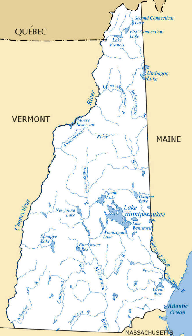
New Hampshire Rivers and Lakes
HOME
INTRO
SYMBOLS
ALMANAC
ECONOMY
GEOGRAPHY
STATE MAPS
PEOPLE
FORUM
NEWS
COOL SCHOOLS
STATE QUIZ
STATE LINKS
BOOK STORE
MARKETPLACE
GUESTBOOK
CONTACT US

New Hampshire Atlas & Gazetteer, by Delorme. 80 pages. DeLorme Publishing; 15th edition (September 1, 2005) The first choice of outdoors enthusiasts. Beautiful, detailed, large-format maps of every state. Perfect for home and office reference, and a must for all your vehicles. Gazetteer information may include: campgrounds, attractions, historic sites & museums, recreation areas, trails, freshwater fishing site & boat launches, canoe trips or scenic drives. Categories vary by state .

AMC River Guide: New Hampshire, Vermont, Appalachian Mountain Club. 328 pages. Publisher: Appalachian Mountain Club Books; 4th edition (April 1, 2007) AMC's classic River Guide describes more than 2,500 miles of river, making it the region's most comprehensive paddling guide. Each river--including the Connecticut, Merrimack, Champlain, Piscataqua, Saco, Androscoggin, and others--is described in detail, with difficulty level, put-in access, scenery, portages, and more. The guide's reader-friendly format, plus new watershed locator maps, makes trip selection and planning quick and easy.
Quiet Water: New Hampshire & Vermont, by John Hayes, Alex Wilson. 352 pages. Appalachian Mountain Club Books; 2nd edition (August 1, 2001) Enjoy days of pleasure exploring the flatwater lakes and ponds of New Hampshire and Vermont. Special features include: detailed descriptions of each lake and pond, with paddling routes, local flora and fauna, and seasonal highlights; driving, parking, and put-in instructions; safety tips; local picnicking and camping spots; equipment choices; advice for padding with children; low-impact travel tips; illustrated sidebars on New England's fascinating waterside wildlife.
Northern Forest Canoe Trail, by The Northern Forest Canoe Trail Organization. Mountaineers Books (August 2005) The official maps produced by the organization that conceived, coordinated and developed the Trail; Flows through New York, Vermont, Québec, New Hampshire, and Maine; Maps include put-in points, portages, campsites, local contact information, and permit guidelines; Water- and tear-resistent color contour maps offer detailed route descriptions With these new maps, 11 of the 13 trail sections are now complete on the Northeast's 740-mile Northern Forest Canoe Trail, an all-new recreation amenity within a day's drive or less of 70 million possible users.
The Connecticut River Boating Guide, Connecticut River Watershed Council. 256 pages. Falcon; 3rd edition (April 1, 2007). The Connecticut River Boating Guide continues to be the classic, authoritative guide for boaters, canoeists, and kayakers on the Connecticut River. This third edition covers the entire waterway from its source at the Canadian border to Long Island Sound, dividing the river into twenty-eight reaches with accompanying GPS-compatible maps. Practical information on boating facilities, ramps, access areas, mileages, difficulty, sources of flow information, and portages makes it easier than ever to plan your next adventure along the river.


NETSTATE.COM is a Trademark of NSTATE, LLC.
Copyright © by NSTATE, LLC. All rights reserved.
No copyright is claimed on non-original or licensed material.
Support NETSTATE
Site designed exclusively for NETSTATE.COM by NSTATE, LLC

