The Geography of Louisiana
Click here for a few definitions.
| Longitude / Latitude |
Longitude: 89°W to 94°W
Latitude: 29°N to 33°N |
|
| Length x Width |
Louisiana is about 380 miles long and 130 miles wide. |
|
Geographic Center
Explanation |
The
geographic center
of Louisiana is located in Avoyelles Parish, 3 miles SE of Marksville.
Longitude: 92° 32.2'W
Latitude: 30° 58.1'N |
|
| Borders |
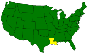
Louisiana is bordered by Arkansas on
the north and the Gulf of Mexico on the south. Mississippi
borders Louisiana on the east and Texas borders
Louisiana on the west. |
| Total Area |
Louisiana covers 51,843 square miles, making it the 31st largest of the
50 states. |
| Land Area |
43,566 square miles of Louisiana are land areas. |
| Water Area |
8,277 square miles of Louisiana are covered by water. |
| Highest Point |
The highest point in Louisiana is
Driskill Mountain
at 535 feet above sea level. |
| Lowest Point |
The lowest point in Louisiana is 8 feet "below" sea level in
New Orleans. |
| Mean Elevation |
The Mean Elevation of the state of Louisiana is only 100 feet above sea level. |
| Major Rivers |
Atchafalaya River,
Mississippi River,
Ouachita River,
Red River,
Sabine River |
| Major Lakes |
Calcasieu Lake,
Catahoula Lake,
Grand Lake,
Lake Maurepas,
Lake Pontchartrain,
Toledo Bend Reservoir,
White Lake
View Gerald Massie's report on some of Louisiana's Lakes:
Louisiana Lakes Described. |
The Land |
| Louisiana can be divided into three geographic land areas.
East Gulf Coastal Plain: The East Gulf Coastal Plain lies to the east of the Mississippi River
north of Lake Pontchartrain. As might be expected, the land is quite low and consists of marshland near the
river. The land rises slightly in the north to rolling hills.
Mississippi Alluvial Plain: The Mississippi Alluvial Plain stretches along the Mississippi River
from Arkansas in the north to the Gulf of Mexico in the south. This area along the river is characterized
by ridges and hollows. Fields atop the ridges along the river are referred to as the "frontlands". The
land contour slopes away from the frontlands to the "backlands", comprised of clay and silt. The Mississippi
Delta, at the mouth of the Mississippi River covers about 13,000 square miles (about 1/4 of Louisiana) and
consists of silt deposited by the river. The Mississippi Delta is the most fertile area of Louisiana.
West Gulf Coastal Plain: The West Gulf Coastal Plain lies west of the Mississippi Alluvial Plain.
In the south, along the gulf, are barrier beaches. Behind the barrier beaches are marshes that extend about
20 miles north into the interior of Louisiana. To the north of the marshlands are the Louisiana Prairies,
characterized by gently rolling landscape. The land gradually rises in the north, toward Arkansas. The
highest point in Louisiana, Driskill Mountain, is only about 40 miles from the Arkansas state line.
( Louisiana Close-up ) |
| Climate (All temperatures Fahrenheit) |
| Highest Temperature |
The highest temperature recorded in Louisiana is 114°, Fahrenheit. This record high
was recorded on August, 10, 1936 at Plain Dealing. |
| Lowest Temperature |
The lowest temperature in Louisiana, -16°, was recorded on February 13, 1899 at Minden. |
| Average Temperature |
Monthly average temperatures range from a high of 93.3 degrees to a low of 36.2 degrees. |
| Climate |
Average yearly precipitation for Louisiana, from 1971 to 2000, is shown on
this chart from Oregon State University. |
|