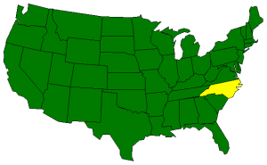
The Geography of North Carolina
Click here for a few definitions.
| Longitude / Latitude |
Longitude: 75° 30' W to 84° 15' W
Latitude: 34° N to 36° 21' N |
|
| Length x Width |
North Carolina is 500 miles long and 150 miles wide. |
|
Geographic Center
Explanation |
The
geographic center
of North Carolina is located in Chatham County, 10 miles NW of Sanford.
Longitude: 79° 27.3'W
Latitude: 35° 36.2'N |
|
| Borders |
North Carolina is bordered by Virginia on the north and by
South Carolina and Georgia on the south. In the east, North Carolina is bordered by
the Atlantic Ocean. On the west, Tennessee is North Carolina's neighbor. |
| Total Area |
North Carolina covers 53,821 square miles, making it the 28th largest of the
50 states. |
| Land Area |
48,708 square miles of North Carolina are land areas. |
| Water Area |
5,103 square miles of North Carolina are covered by water. |
| Highest Point |
The highest point in North Carolina is Mount Mitchell at 6,684 feet
above sea level. |
| Lowest Point |
The lowest point in North Carolina is at the shore where North
Carolina meets the Atlantic Ocean; sea level. |
| Mean Elevation |
The Mean Elevation of the state of North Carolina is 700 feet above sea level. |
| Major Rivers |
Neuse River, Roanoke River, Yadkin River |
| Major Lakes |
Lake Mattamuskeet, Lake Phelps, Lake Waccamaw |
The Land |
| The eastern 2/5 of North Carolina is characterized as coastal plain and tidewater.
Moving west, the next 2/5 of North Carolina, about 200 miles wide, consists of a
piedmont plateau. In the west, the land slopes upward from gentle to rugged rolling hills
to the high southern Appalachian Mountains containing the Blue Ridge and Great
Smokey Mountains.
( North Carolina Close-up ) |
| Climate (All temperatures Fahrenheit) |
| Highest Temperature |
The highest temperature recorded in North Carolina is 110°, Fahrenheit. This record high
was recorded on August 21, 1983 at Fayetteville. |
| Lowest Temperature |
The lowest temperature in North Carolina, -34°, was recorded on January 21, 1985
on Mount Mitchell. |
| Average Temperature |
Monthly average temperatures range from a high of 88.3 degrees to a low of 27.3 degrees. |
| Climate |
Average yearly precipitation for North Carolina, from 1971 to 2000, is shown on
this chart from Oregon State University. |
|