
| Suggest a link | |
| Report broken link |


Oklahoma Base and Elevation Maps
The two maps shown here are digital base and elevation maps of Oklahoma. Higher resolution maps like
these and many other digital maps, wall maps, custom radius maps, travel maps, travel guides, map software, and globes and
games, for business and the classroom, are available to purchase from
Maps.com - The World's Largest Maps Store!.
Enter code "NETSTATE" at checkout for 10% off orders of $50 or more!
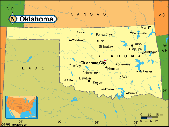 |
This Oklahoma base map highlights the location of the state capitol, Oklahoma City, and major cities throughout the state. Portions of Oklahoma's border states, Kansas, Missouri, Arkansas, Texas, New Mexico, and Colorado are included to show the relationship between Oklahoma and its neighbors. A small inset shows Oklahoma among the other 47 Continental United States. |
| Oklahoma base map, Courtesy of Maps.com. |
|
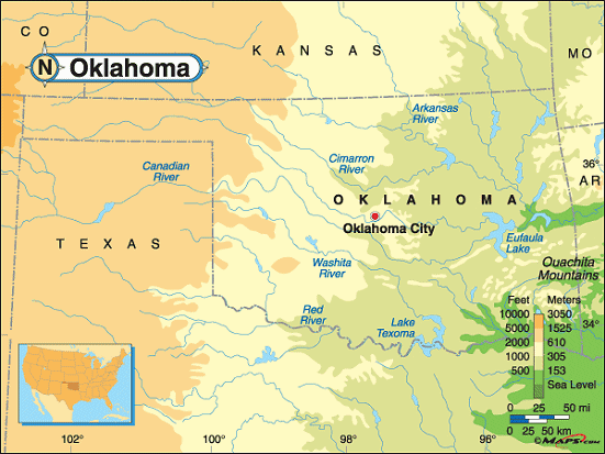 |
This elevation map of Oklahoma illustrates the number of feet or meters the
state rises above sea level. Averaging 1,300 feet above sea level, Oklahoma is a land of flat, fertile plains and
low hills.
The highest point in the state, Black Mesa, is 4,973 feet above sea level and is located in the Oklahoma panhandle, Cimarron County, less than a mile east of the New Mexico border about 36 miles northwest of Boise City and about 2 1/2 miles northwest of Kenton. |
| Oklahoma elevation map, Courtesy of Maps.com. |
Additional information
Oklahoma maps: Additional maps and map links from NETSTATE.COM.
Oklahoma geography: More Oklahoma geography from NETSTATE.COM.
Purchase Oklahoma maps:
Maps.com - The World's Largest Maps Store!
- Select map type by clicking on "category" to left on destination page.
- Use code NETSTATE at the checkout for 10% off orders of $50 or more!
- Over 6,000 products to choose from!
Site designed exclusively for NETSTATE.COM by NSTATE, LLC

NETSTATE.COM is a Trademark of NSTATE, LLC.
Copyright © © by NSTATE, LLC. All rights reserved.
No copyright is claimed on non-original or licensed material.
Support NETSTATE