The Geography of New Mexico
Click here for a few definitions.
| Longitude / Latitude |
Longitude: 103°W to 109°W
Latitude: 31° 20'N to 37°N |
|
| Length x Width |
New Mexico is about 370 miles long and 343 miles wide. |
|
Geographic Center
Explanation |
The
geographic center
of New Mexico is located in Torrence County, 12 miles SSW of Willard.
Longitude: 106° 6.7'W
Latitude: 34° 30.1'N |
|
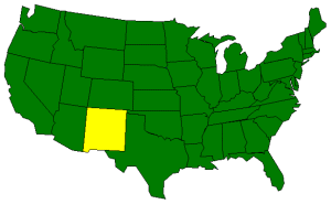
| Borders |
New Mexico is bordered by Colorado
on the north. On the south, New Mexico is bordered by
Texas and New Mexico shares an international border with Mexico.
On the east, New Mexico is bordered by Oklahoma and Texas.
On the west, New Mexico is bordered by Arizona. |
| Total Area |
New Mexico covers 121,598 square miles, making it the 5th largest of the
50 states. |
| Land Area |
121,365 square miles of New Mexico are land areas. |
| Water Area |
234 square miles of New Mexico are covered by water. |
| Highest Point |
The highest point in New Mexico is Wheeler Peak at 13,161 feet
above sea level. |
| Lowest Point |
The lowest point in New Mexico is 2,842 feet above sea level at
the Red Bluff Reservoir. |
| Mean Elevation |
The Mean Elevation of the state of New Mexico is 5,700 feet above sea level. |
| Major Rivers |
Rio Grande, Pecos River |
| Major Lakes |
Elephant Butte Reservoir, Conchas Lake, Navajo Reservoir |
The Land |
| The eastern third of New Mexico is covered by the Great Plains. The Great Plains
run from a high plateau in the north south to the Pecos River. Rivers in the high
plateau have cut deep canyons into the landscape. This area is use for sheep and
cattle ranches. To the south, dry farming and irrigated agriculture is possible.
South of the Canadian River, along the eastern edge of New Mexico, the land is
referred to as the High Plains or Staked Plains (Llano Estacado). These High Plains
run along the Texas border in New Mexico.
In the central part of New Mexico, the Rocky Mountains extend into New Mexico from
Colorado to the north. The Rio Grande River cuts through the Rocky Mountains from
north to south. East of the Rio Grane, is the Sangre de Cristo (Blood of Christ) Mountain range.
Wheeler Peak, the highest point in New Mexico is found in this range. To the west of the Rio Grande are
the Nacimiento and Jemez Mountain ranges. The fertile Rio Grande Valley provides suitable farm land using
modern irrigation techniques.
The Basin and Range Region covers about 1/3 of the state and lies at to the south
of the Rocky Mountain Region. This region extends south from around Santa Fe to
Mexico and west to Arizona. This area is marked by rugged mountain ranges, such as
the Guadalupe, Mogollon, Organ, Sacramento, and San Andres mountain ranges, separated
by desert basins. The Rio Grande River flows north to south through the Basin and
Range Region and exits New Mexico in the south to form the border between Texas and
Mexico.
( New Mexico Close-up ) |
| Climate (All temperatures Fahrenheit) |
| Highest Temperature |
The highest temperature recorded in New Mexico is 122°, Fahrenheit. This record high
was recorded on June 27, 1994 at Lakewood. |
| Lowest Temperature |
The lowest temperature in New Mexico, -50 °, was recorded on February 1, 1951 at Gavilan. |
| Average Temperature |
Monthly average temperatures range from a high of 92.8 degrees to a low of 22.3 degrees. |
| Climate |
Average yearly precipitation for New Mexico, from 1971 to 2000, is shown on
this chart from Oregon State University. |
|